Welcome to the Alps of Southern California. If you are looking into living in Lake Arrowhead or planning a visit, the first thing you need to understand is the topography. This isn’t a walkable urban center where you can stroll from your front door to the grocery store; it is a spread-out alpine community built into a rugged forest.
Because the terrain involves steep grades, winding roads, and significant elevation changes, how you get around dictates your entire experience here. While the scenery is breathtaking, the logistics require some planning. To put it simply: a personal vehicle isn’t just a recommendation for living here—it is virtually mandatory if you want a stress-free experience.
Getting Here: Driving the Rim of the World Highway
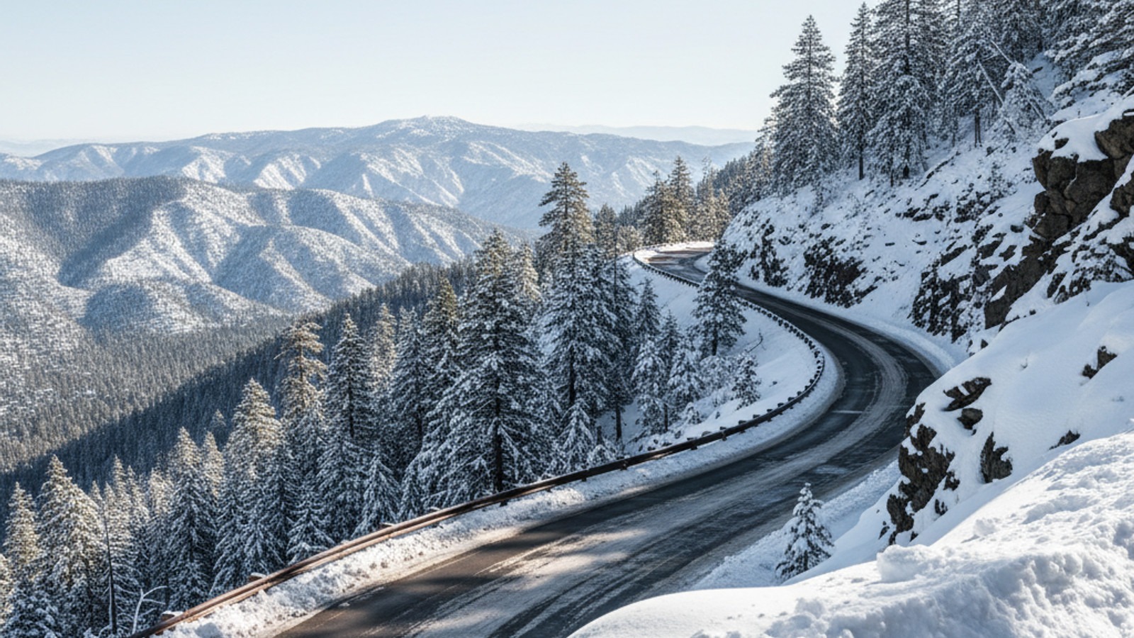
Most journeys to our mountain begin on Highway 18, famously known as the “Rim of the World Highway.” It’s one of the most scenic drives in the state, offering sweeping views of the San Bernardino Valley below, but it demands your full attention.
The drive involves a significant elevation gain, climbing roughly 4,000 feet in just about 20 minutes of driving. The road is well-maintained, but it features sharp curves and steep drop-offs. If you have passengers who are prone to car sickness, I always suggest taking Dramamine before you start the ascent or planning for a few stops at the designated turnouts.
Speaking of turnouts, using them is a major part of local driving etiquette. If you are driving slower to take in the views (which you should!), please pull into a turnout to let the line of cars behind you pass. It keeps traffic flowing and reduces stress for everyone. While Highway 330 and Highway 173 offer alternative routes, Highway 18 is generally the most direct and reliable path unless there is a specific road closure.
The Reality of Public Transit & Rideshare
One of the most common mistakes I see visitors make is assuming they can rely on apps like Uber or Lyft once they get up the mountain. Let’s be very clear about this: rideshare services are notoriously unreliable in Lake Arrowhead.
While you might find a driver willing to bring you up the mountain from San Bernardino or Redlands, finding a driver locally to pick you up and take you back down—or even just to dinner—is extremely difficult. Drivers rarely hang around the mountain due to the distance between fares, and wait times can easily exceed 45 to 60 minutes, if a car shows up at all. I have seen many visitors stranded at the Village or a rental cabin because they banked on an Uber that never came.
We do have the Mountain Area Regional Transit Authority (MARTA), but it is designed more for community connectivity than on-demand travel. It runs on a limited schedule and is viable for getting between major hubs, like going from Lake Arrowhead to Crestline. However, it is not a solution for “last mile” travel to specific residential cabins tucked away on side streets.
Winter Driving & Chain Controls: What You Must Know
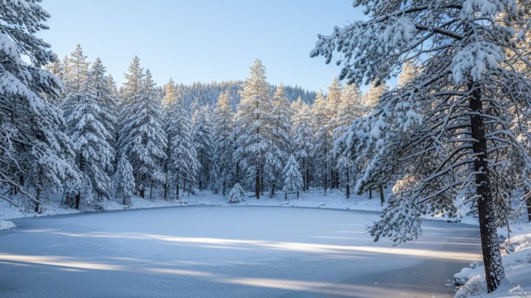
If you are looking at homes for sale in Lake Arrowhead or visiting between November and April, you need to respect the weather. Conditions change rapidly; it can be sunny and 70 degrees in San Bernardino and actively snowing with icy roads just 30 minutes later at the lake.
CalTrans enforces chain controls strictly for the safety of all drivers. You will see checkpoints where officers verify you have the right setup. Here is how the levels work:
- R1: Chains are required, though snow tires are usually acceptable.
- R2: Chains are required on all vehicles unless you have a 4WD/AWD vehicle with snow tires on all four wheels.
- R3: Chains are required on ALL vehicles, no exceptions. This is rare and usually implies the road is about to close.
There is one golden rule for winter driving here: You must legally carry chains in your vehicle during winter months, even if you have a 4WD truck and the sun is shining. Conditions can shift in minutes, and CalTrans may require you to show them. Also, keep an eye out for black ice, especially on shaded corners that don’t get sunlight during the day.
Tips for Navigating Local Roads
Once you have arrived, driving within the residential neighborhoods presents its own unique set of challenges. The first thing you will notice at night is how dark it gets. Most residential streets do not have streetlights, so you are relying entirely on your headlights. High beams are necessary, but remember to dim them immediately for oncoming traffic or homes.
GPS signal can also be spotty in the deeper canyons. It is a smart move to download offline maps to your phone before you head up the hill so you don’t lose navigation halfway to your destination.
The roads themselves are often narrow, winding, and lined with trees. In many older neighborhoods, two cars can barely pass each other. The general rule of mountain driving is that uphill traffic has the right of way. If you are heading downhill and meet a car coming up on a narrow patch, you are expected to reverse or pull over to let them pass. Finally, pay close attention to parking regulations. Parking is strictly regulated, especially during snow plow operations, and getting towed in a blizzard is an experience you want to avoid.
Pedestrian Access: Private Trails vs. Public Spots
There is often confusion regarding where you can and cannot walk. Many people see the beautiful trail winding around the water’s edge and assume it is a public boardwalk. However, the “Lake Arrowhead Trail” is private property owned and maintained by the Arrowhead Lake Association (ALA).
Access to this trail requires active membership or guest passes, and security patrols are common. If you are buying lake rights property, you will gain access to this amenity, but for general visitors, it is off-limits.
That doesn’t mean there aren’t places to stretch your legs. Lake Arrowhead Village offers a public boardwalk area with great views of the water. For a more nature-focused walk, the Heaps Peak Arboretum offers a lovely, easy loop that is open to the public. Just remember that the lake itself is private, so launching your own boat is generally restricted to property owners with ALA rights.
Nearest Airports & Rental Car Strategy
For those flying in to visit or check out real estate, Ontario International Airport (ONT) is by far the most convenient major hub. It is roughly a 45 to 60-minute drive to the mountain, depending on traffic. San Bernardino International Airport (SBD) is technically closer, but it currently supports fewer commercial flights.
If you are renting a car, strategy matters. If there is even a slight chance of rain or snow in the forecast, do not rent an economy sedan. Upgrade to an AWD or 4WD SUV. It provides better traction on the winding roads and ensures you comply with R2 chain controls without having to stop and install chains in the slush.
Frequently Asked Questions
Can I use Uber or Lyft to get around Lake Arrowhead?
You should not rely on them. While you might get a ride to the area, availability within Lake Arrowhead is extremely scarce, and drivers often refuse to drive up the mountain. You risk getting stranded without a personal vehicle.
Are snow chains really required if I have an SUV?
Yes, you are legally required to carry them in your vehicle during winter months, regardless of what you drive. During R2 conditions, 4WD/AWD vehicles with snow tread tires can proceed without installing chains, but you must still have them on board in case conditions worsen to R3.
Is Lake Arrowhead walkable?
Lake Arrowhead Village is walkable, featuring shops and restaurants. However, the residential areas are spread out over steep terrain with no sidewalks, making the community as a whole not suitable for walking as a primary mode of transportation.
How far is Lake Arrowhead from Los Angeles?
Lake Arrowhead is approximately 90 minutes from Los Angeles, though this depends heavily on traffic conditions on the freeways leading to the base of the mountain.